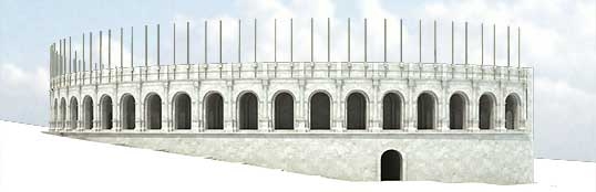
The reconstitution was largely based on amphitheatres at Nimes and Arles. Nevertheless, it gives us an idea of the monumental size of the Parisian structure.
3D graphics: © A.-B. Pimpaud.
The amphitheatre was located outside of the Early Roman city. All attempts by archaeologists to integrate the structure into the ancient road system-often by extending it-have proved fruitless.
Using a practice that was much employed in antiquity, the builders used the contours of the land, in this case the southwest face of the Sainte-Geneviève hill, to situate the monument. Using this natural incline meant that the size of the substructure needed to support the cavea could be reduced, if not completely eliminated.
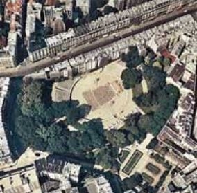
Aerial view of the amphitheatre. Restored view, map and current state.
3D graphics: © A.-B. Pimpaud. Map: © D. Busson et V. Charlanne.
Photo: © IGN Photothèque Nationale - 1969.
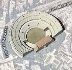
Aerial view of the amphitheatre. Restored view, map and current state.
3D graphics: © A.-B. Pimpaud. Map: © D. Busson et V. Charlanne.
Photo: © IGN Photothèque Nationale - 1969.