
Contemporary Dobrogea.
An integral part of Romania, Dobrogea lies between the lower tributary of the Danube and the coast of the Black Sea and forms a rather distinct, natural headland. The hilly ridge culminates in the north at Mount Macin, 467 meters above sea level, and slopes down gently toward the south.
The rest of the Hercynian and Caledonian Mountains lie to the north, flattened in shape, by erosion. Dobrogea is situated in the driest part of Romania. The region receives less than 400 mm (15.74 in.) of precipitation per year with temperatures ranging from higher than 40° C (104° F) in the summer to less than -30° C (-22° F) in the winter. The short and fast-moving rivers are dry for most of the year.
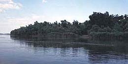
Dobrogea is host to some peculiar wildlife and flowers. The hills are covered with oak, European hornbeam, and linden trees ; willow and poplar grow in the Danube Delta ; and in the central and southern region the vegetation is that of steppe land or prairie with its low grass and shrubbery. Next to the Danube Delta itself, Dobrogea holds numerous speleological, zoological, botanical and fossil reserves.
The Danube in Dobrogea.