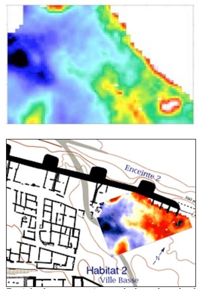
Remote sensing maps. Prospection L. Aubry, © Terra Nova, 1999
Plan of Entremont.
The excavation of tomorrow, why? With the publication of the excavations from 1946 to 1999 now completed, new field operations are planned. Meanwhile, are not the data recovered from a half-century of excavation sufficient to understand the essential phases in the structuration of this settlement and its socio-cultural components? Two examples suffice to illustrate a few of the significant scientific interrogations that remain unanswered: only 15% of the surface area of the site has been explored. The existing documentation concerning the “high city” is insufficient. Complementary research is also necessary in this sector in order to respond to the needs dictated by the project to present to the public a coherent, in-situ ensemble of the remains exposed and restored. We are still ignorant of the nature and form of the occupations of other sectors of the plateau, in particular the potential existence of vast open spaces that could have served the role of public squares, or other social functions within the neighborhoods. The hypothesis that almost all of settlement 2 was highly concentrated thus remains to be verified.
Large sectors of the principal access road into settlement 2 remain completely untouched. It is certain that they contain hundreds of fragments of intentionally broken statues, as well possible remains of the locations where they were presented. A precise understanding of this open space behind the door and the possible adjoining buildings, as well as their transformation during the second half of the 2nd century, is essential to refining our perception of the social relations of the period and their collective manifestations.
Within the next few years, a new multi-disciplinary research team and excavation project will be formulated in order to continue the important study of this major Protohistoric settlement of the Provence region.