
In 1993 DRASSM archaeologist Luc Long and a team from the IFREMER research institute achieved the technological feat of using a submersible and a robotic device to survey an archaeological site. Discovered in 1988 off Arles Beach, the site lies at a depth of 662 metres.
A key moment in the development of deep-water archaeology
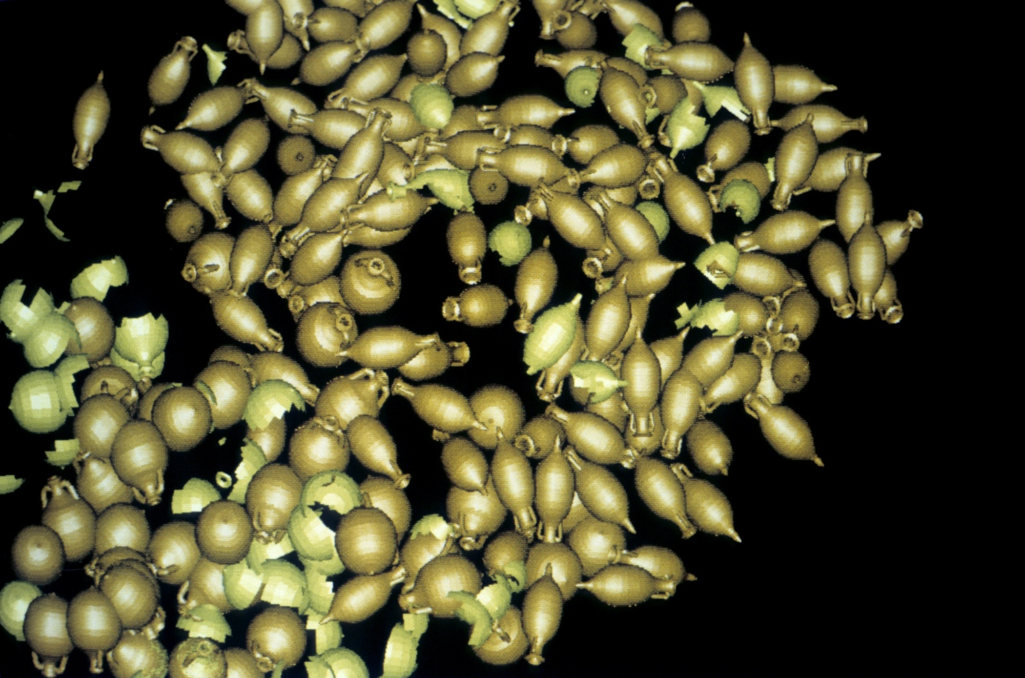
Probably hailing from Baetica (a Roman province in the south of Spain), the vessel was undoubtedly heading for the mouth of the Rhône with goods for its Gallo-Roman clientele when it sank in AD 1. It was carrying up to 2,000 amphorae of various shapes, and these were easy to identify because concretions do not form at such depths. Ceramics and copper ingots completed this meticulously stowed cargo. An iron anchor indicated the vessel’s bow, while her frames protruding out of the sand suggested a well-preserved hull. Indeed, xylophages or wood-eating worms are unable to survive in deep ecosystems.
Evidence based on images
The operation trialled the use – on a deep-water site – of a submersible to take photographs (nothing was sampled or moved) which could be subsequently processed to generate 3D images of the amphorae and their relative positions. Even if some of the data potential was lost (inscriptions, painted marks, etc.), the computer-generated images of the wreck enabled archaeologists to analyse its cargo in terms of layout, quantity, and size. Images of the deposit were leveraged to produce a short but realistic film (20 s), thus prefiguring the development of virtual reality in archaeology or archaeomatics. Immediately subsequent to this experimental operation DRASSM acquired its first ROV, an Achille.

