
Since the 2000s, LiDAR (Light Detection and Ranging) has been used increasingly by archaeologists to identify and study remains over extensive forested areas.
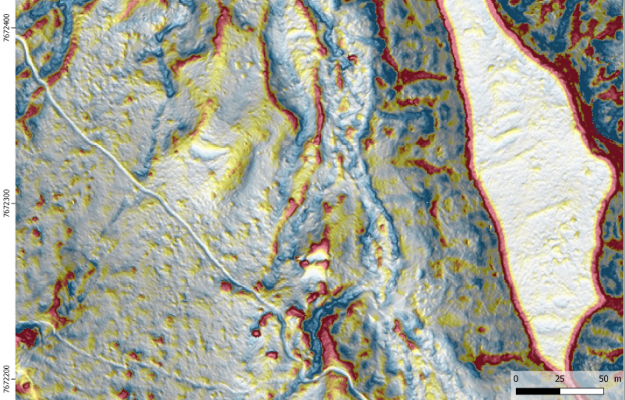
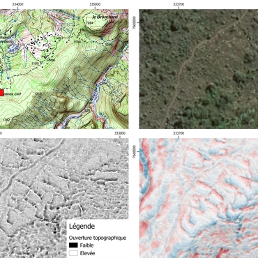
Topographical LiDAR consists in scanning the ground with a laser range-finder fitted to an aircraft. The resulting point cloud removes the tree coverage to produce a topographical record of the ground. Filtering produces an accurate digital model of the terrain, allowing specialists to process the image and reveal reliefs, even under the tree canopy.
This method helps archaeologists reveal structures that were once difficult to locate and record effectively, including the topographical footprint of previous occupations with extremely weak signatures, sometimes just a few dozen centimetres in size. Archaeologists have made several helicopter-mounted surveys of Réunion to make a more systematic analysis of difficult terrain. They have produced LiDAR surveys as part of research projects relating to two cirques - Mafate (Plateau Picard) and Salazie - and Maïdo after it was swept by fire, on the initiative of the regional archaeology department and the regional inventory department. In 2019, the Département de La Réunion commissioned a LiDAR survey to map remains on Îlet à Guillaume. Since 2019, this technique has also proven effective when used as part of large-site rescue archaeology surveys, including in Saint-Leu and Saint-Benoît.
Diachronic by definition, this research aims to map the terrain for use on planned field missions with specific project designs. Archaeologists then compare the survey data with their observations and study remains in the field with the highest scientific potential.
To learn more, read the article on the website of the Ministère de la Culture.
Associated media
Open Media Library

Digital terrain model (Saint-Denis, Îlet à Guillaume)

Relief variations (Saint-Denis, Îlet à Guillaume)

LiDAR equipment

LiDAR survey (Saint-Leu, Ravine du Trou)

3D model of the Îlet à Guillaume (Saint-Denis, 2020)

Terrain digital model (Saint-Paul, Cirque de Mafate)

Field walking surveys
Roche Plate (Saint-Paul)
