
Inrap performed an archaeological evaluation on rue de la Batterie at Saint-Denis in 2018, prior to the construction of a cinema.
Archives
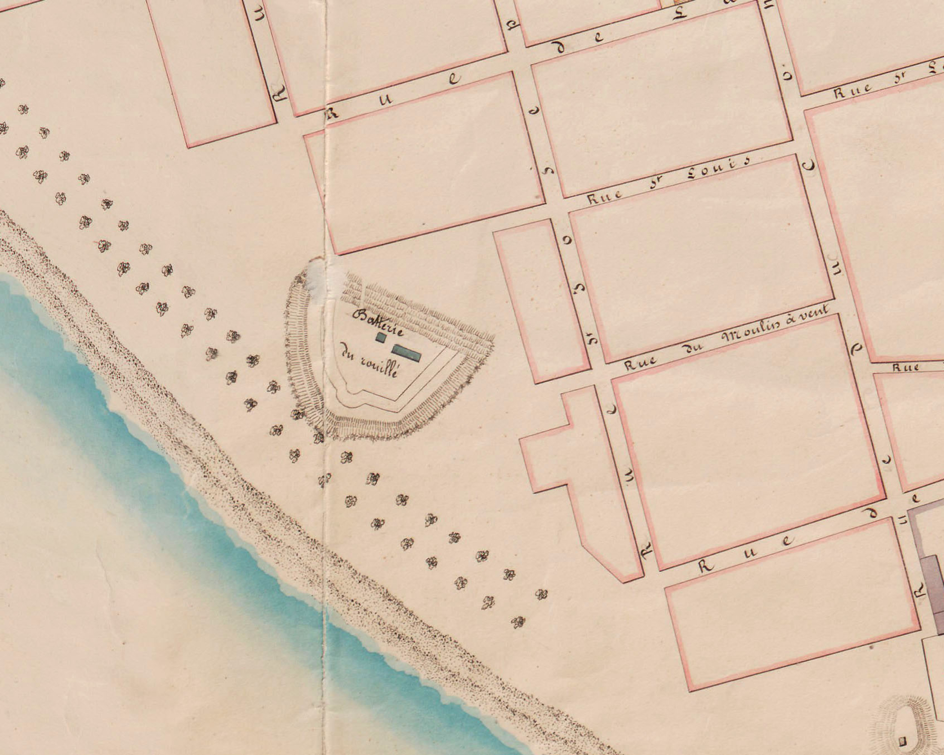
Given its proximity to the seafront and the street’s toponomy, and based on the study of old maps, archaeologists expected to find evidence of the area’s initial urbanisation and the town’s former defensive system. According to a map drawn up by G. Robin in 1842, the evaluated plot corresponds to the site of the "Rouillé" battery, once part of a series of five batteries defending the natural harbour off the coast of Saint-Denis.
The terrain
Only test pit no. 1 revealed the remains of a rectangular structure measuring 4 metres long by 3.1 metres wide and some 1.3 metres deep. A visible step a few centimetres to the southwest of the structure and small trenches bordering two rectangular spaces attest to a construction built in perishable materials on a low soleplate. The existence of brown stains (the only surviving remains of wood used in the construction), nails and metal points provide further evidence for this theory. Ceramic finds and a fragment of kaolin pipe stem date the structure to the 19th century.


