
The Euphrates
A major commercial centre, the city of Mari stood at the centre of a dense road network. The Euphrates was a major trade artery and a series of caravan routes radiated out from Mari. Texts found in City II and City III reveal the importance of water and land transport. Although no remains of boats have been found in Mari, textual sources and discoveries made on other sites suggest they were made of wood or reed caulked with bitumen. They were used to transport Syrian and Anatolian products, wood, oil, wine and metals downstream. The </span><em>karum </em>of Mari, the port located on the banks of the canal, has unfortunately disappeared; mentioned in textual sources, its activities spanned river and canal transport and the organisation of caravans.
Caravan routes
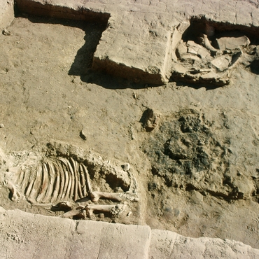
Mari stood at the centre of a network of caravan routes stretching from the Euphrates to the Mediterranean, through cities such as Palmyra, and eastwards to the Tigris Valley. The donkey was the main pack animal; the dromedary was only used for transport from the 1st millennium. The domestic horse only appeared at the end of the 3rd millennium, in the Amorite period; it was a luxury to own a horse. The last king of Mari, who hesitated between entering the city on a horse or a donkey, had a stable built in the palace courtyard for his horses. Excavations carried out in Mari at Site L, at levels corresponding to City I, have yielded some of the oldest complete skeletons of domestic donkeys discovered in the Near East. The mother-of-pearl mosaics from City II depict Sumerian-style carts drawn by horses.
The remains of a wheel with traces of bitumen were found in 2002 at the levels of City I. Dated to 2750 BCE, they are the oldest wheel remains discovered in the Near East. This wheel was made of three planks of wood juxtaposed and caulked with bitumen. According to the texts, Mari was famous for the quality of its carts.
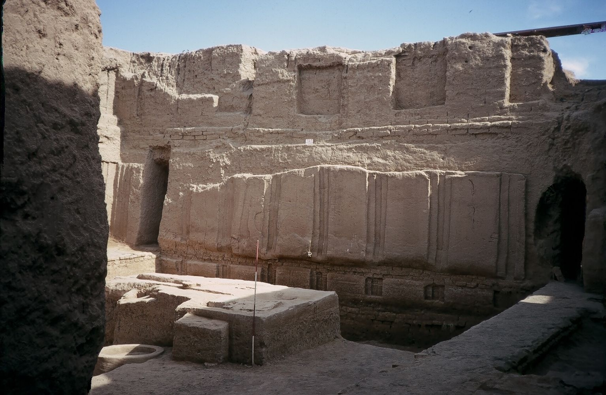
Moving around the city
At the northeast entrance of the palace, the tracks made by the repeated passage of these carts are still visible. Pack donkeys and teams of animals were moving around the city of which the main streets, which had a radio-centric plan, were 4.7 metres wide. The best known of these streets is the "holy way" which ran along the Massif Rouge to the east and was lined with sanctuaries. The streets were covered with layers of gravel that absorbed rainwater. Two city gates have been excavated and the width of the passage was also 4.7 metres.