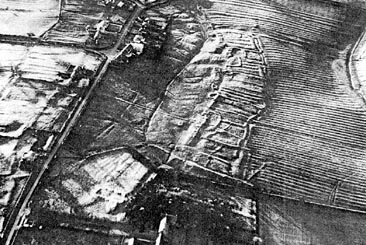
The long-vanished medieval village of Ogle in Great Britain. Photo: J. K. Saint-Joseph.
In Great Britain in 1922, O.G.S. Crawford was the first to detect archaeological sites that had been completely leveled in regions where widespread agriculture had rendered sightings more difficult. With the help of a colleague, who financed the first systematic prospecting in Wessex, Crawford published what would be a fundamental book for the history of the discipline (Crawford et Keiller 1928), and then another spectacular volume in 1929. The heaven-sent revelation of the "ghosts of Wessex",
and then another spectacular volume in 1929. The heaven-sent revelation of the "ghosts of Wessex" was greeted with general amazement and great enthusiasm. Starting in 1939, truly remarkable photographs were taken by Professor John Kenneth Saint-Joseph After the war, he continued to fly, using Royal Air Force planes. Then, from a specially-equipped plane belonging to Cambridge University, and with the help of a very experience pilot, Saint-Joseph (1966) took hundreds of thousands of large-format black and white photographs until 1980. Not content with merely being a flying archaeologist, he also photographed and studied everything that could be of interest in a wide range of scientific domains. He specialized in the excavations of Roman camps.
In Germany, research began in 1960, led by Irwin Scollar and then Otto Braasch. Charles Léva would do the same in Belgium in 1965, and it was Léva who used his own money to create an important Interdisciplinary Aerial Research Center (CIRA).
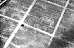
Detail of the Roman town of Silchester (Hampshire), Great Britain. Photo: J. K. Saint-Joseph.
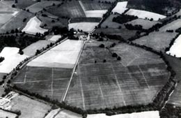
Overall view of a Roman town, Silchester (Hampshire), Great Britain. Photo: J. K. Saint-Joseph
Elsewhere in Europe, studies have developed more recently in Italy, Spain, the Netherlands, Romania, Switzerland, Luxembourg, and Sweden. To learn more about these various efforts, see the proceedings of the most recent international aerial archaeology colloquium, which was held in Amiens in 1992 (published in 1999 under the direction of B. Bréart).
In Metropolitan France, it was only after 1950 that archaeologists demonstrated that aerial surveys, such as those carried out by the IGN, could reveal not only major structures such as Roman roads, but also buried remains, even in areas where agriculture had leveled every trace of them.
This was thanks to, among others, Roger Chevallier, P. Lebel, J. Bradford about use of aerial surveys from IGN. Le Gall's efforts at Vieil-Evreux (Eure) were so remarkable that they inspired some archaeologists to try it themselves, using planes from flying clubs and small, amateur 35mm cameras.


