
In 2012 and 2013, on the occasion of the production of a documentary film, a large-scale survey was conducted and small submarines were used to involve veterans in the investigations.
Numerous partners
The project, “D-Day, the Odyssey”, led by Sylvain Pascaud (Libre comme l’air - LCL Production) received wide media attention as it resulted in the production of a documentary film of the same name (directed by Marc Jampolsky, Thalassa). Carried out over a total period of six weeks in 2012 and 2013, the project collaborated with the Woods Hole Oceanographic Institution (WHOI), the United Kingdom Hydrographic Office (UKHO), as well as the Naval History and Heritage Command (NHHC) of the US Navy. The expedition also benefited from partnerships with the Department of Underwater and Marine Archaeological Research (DRASSM - project manager Olivia Hulot) and the French Navy. The 2012 operation was carried out from the ship André Malraux (DRASSM). In 2013, the survey phase utilised the catamaran Étoile Magique (Étoile Marine Croisieres), while the submarines were launched from the André Malraux.
Results of the 2012 and 2013 operations
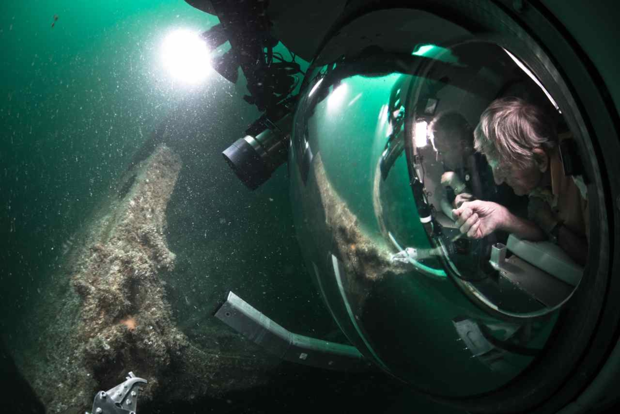
The week-long 2012 operation, aimed to test different geophysical survey equipment in the Baie de Seine. During this mission, approximately ten wrecks previously identified by Caen Plongée divers, were documented using a multibeam echo sounder or a side-scan sonar. In 2013, some of these sites were verified by divers, using a ROV or by submarines equipped with onboard cameras. On this occasion, several D-Day veterans were able to explore the wrecks onboard a submarine. Archaeologists from the US Navy, the Royal Navy and the DRASSM, historians and bomb disposal divers also contributed their expertise. The sites documented on this occasion include the Belgian passenger liner Léopoldville, off Cherbourg, the German submarine U390, the ocean liner Susan B. Anthony, the LST 523, the Liberty ship Charles W. Elliot, the destroyer HMS Lawford, the minesweeper HMS Pylades, as well as several barges, armoured vehicles and artificial harbour components.
The most important contribution of the 2013 operation was a systematic geophysical survey, using a side-scan sonar and a multibeam echo sounder, on the southern section of the Baie de Seine, in order to locate undocumented remains of the D-Day landings. Led by hydrographer Andy Sherell, this survey resulted in the collection of new data over an area of 511 km2, extending 10 km from the coast. Although all this data was not used during the operation, it has been an invaluable resource for research conducted by the DRASSM since 2015.
