
Between 2000 and 2012, American, Canadian and British historians, hydrographers and archaeologists documented their respective military remains. The first structure to conduct this type of research was the US Navy.
A systematic survey of 47 km2
Between 2000 and 2002, the Underwater Archaeology Branch of the Naval History and Heritage Command (NHHC) of the US Navy, under the direction of Dr Robert S. Neyland, Barbara Voulgaris and James S. Schmidt, conducted a vast underwater archaeological survey off Utah Beach, Pointe du Hoc, Omaha Beach and the Banc du Cardonnet. In 2004, a similar operation was also carried out by a Canadian team, in front of Juno Beach, but unfortunately the sources of this operation remain unavailable.
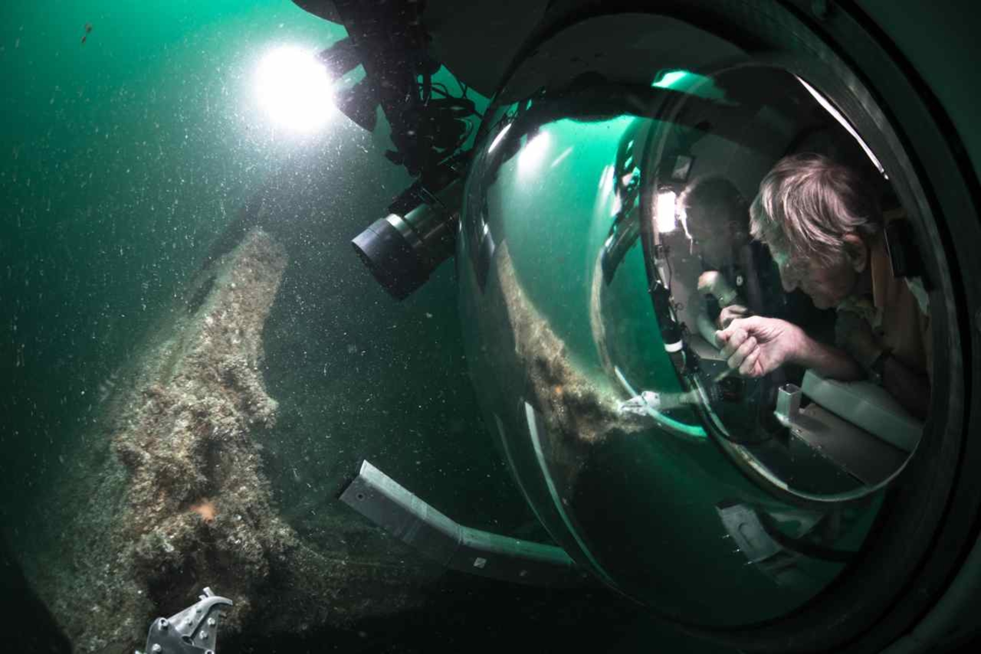
The American research was first carried out in collaboration with the Institute of Nautical Archaeology (INA) of Texas A&M University, before being continued in 2001 and 2002 by the NHHC alone. The aim was to locate, through systematic geophysical surveying, the wrecks, aircraft, armour and artillery elements lost by the US Navy during Operation Neptune. By mapping these remains, researchers are better able to understand the D-Day landings and compare these findings with the data provided by the archives.
The surveys used a side-scan sonar, a magnetometer and, in an innovative way, a multibeam echo sounder. They systematically documented the four study areas, covering a total surface area of 47 km2. Some points were then documented using a Remotely Operated Vehicle (ROV).
Results of the research
At Omaha Beach the remains of the troop carrier Susan B. Anthony, several barges and other vessels, as well as 12 tanks were documented. The NHHC also conducted a complete survey of the structures of Mulberry A (for American), destroyed by a storm but whose caissons, pontoons, floating roads and blockships still remain on the seabed.
Off Utah Beach, the remains of the Liberty ship Charles Morgan, two barges, a Landing Barge Emergency Repair (LBE) and a Landing Barge Vehicle (LBV), as well as those of Gooseberry no. 1 were studied. Surveys conducted around the remains of the minesweeper USS Tide and the destroyer USS Rich show that these ships were reduced to rubble by scrap metal salvage activities. In the Banc du Cardonnet area, which contained one of the enemy’s bottom mine booms, several Landing Craft Tank (LCTs) and some armour were spotted, as well as the destroyer USS Meredith and the freighter HMS Minster. Northeast of Pointe du Hoc, a Landing Ship Tank (LST), the supposed LST 523, was also documented. Finally, a Landing Craft Assault (LCA) and a Landing Craft Infantry (LCI) were located north of Pointe du Hoc and in the Pointe et Raz de la Percée area. The remains of the destroyer USS Corry, heavily scrapped after the war, were searched for without success in the Banc de Saint-Marcouf.

