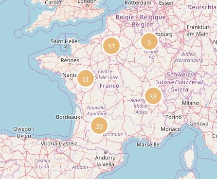
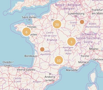
CTG excavations map
Enquête archeologie.culture.gouv.fr - Prenez 3 minutes pour répondre à l'enquête et améliorer archeologie.culture.gouv.fr !
Created to produce topographic maps and dictionaries, the Commission de Topographie des Gaules carried out extensive work to identify archaeological sites in the field between 1858 and 1879. Surveys, photographs, reports and estampages, now held in multiple collections, reveal the scale of these efforts that laid the foundations for a scientific approach to archaeology.
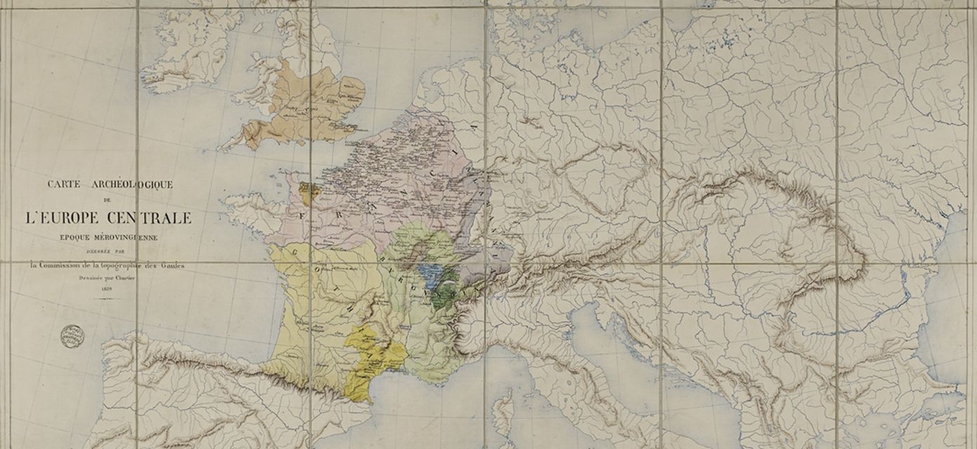
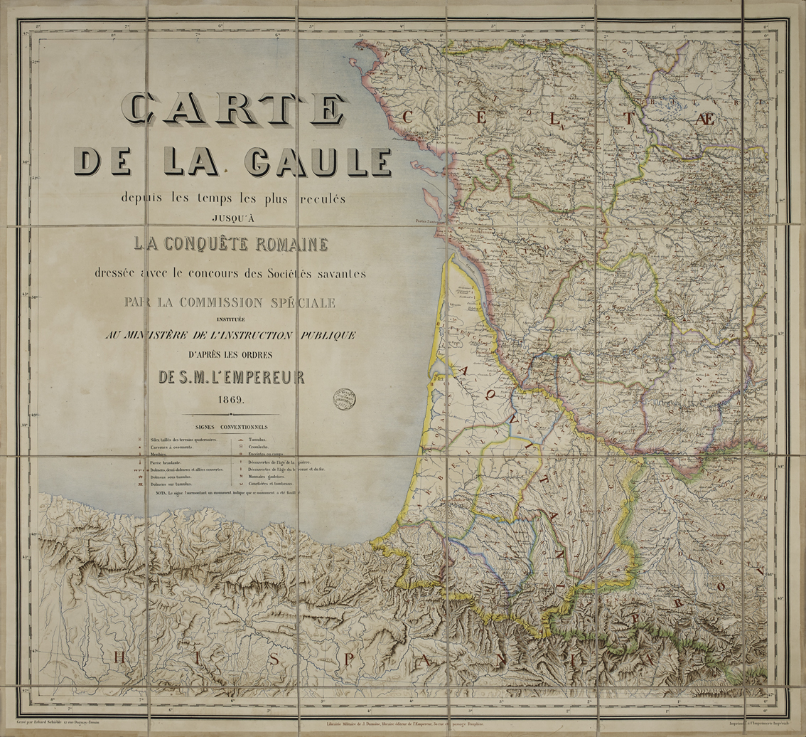
The Commission de Topographie des Gaules, or CTG, was appointed on 17 July 1858 on the initiative of Napoleon III, who wished to gather material for his History of Julius Caesar and provide France with evidence of its ancient past by studying sites that had played an important role in the Gallic Wars.
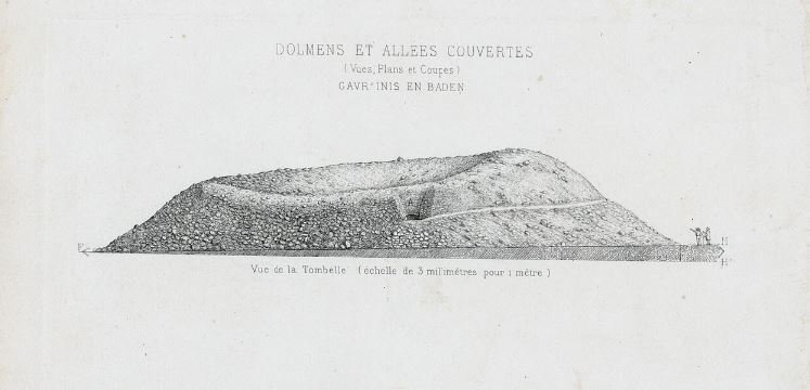
The commission’s specific aim was to publish three maps and two dictionaries in order to shed light on Celtic, Gallo-Roman and Merovingian Gaul. Headed by Félix de Saulcy, the CTG built up a vast network of correspondents in every administrative division or département of France, assisted by learned societies. Members of the military, archivists, teachers, clergymen and other prominent figures were mustered to gather information and objects and send them to the Ministry of Education using a clear methodology. The exercise rapidly turned into a comprehensive survey, going beyond its initial brief to include prehistoric remains.
The CTG was abolished on 20 January 1880 and officially replaced by the Commission de géographie historique de l'ancienne France.
The CTG’s emphasis on recording data, such as maps, surveys, memoirs, photographs and objects, shows how national archaeology in the mid-19th century was evolving into a scientific discipline and explains the growing interest in historical geography.
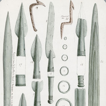
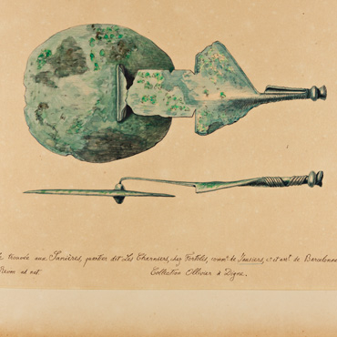
However, the CTG continued to produce traditional epigraphic surveys as shown by the numerous notebooks, estampages and plates produced by General Creuly.
The Musée gallo-romain (now the Musée d'Archéologie nationale), under its director Alexandre Bertrand, made the results of this vast enterprise available to the public in its galleries when it opened in 1867.
The CTG website is the culmination of a lengthy process of collecting and analysing archives, now widely scattered. It provides an overview of those in charge of the project, its method, the documents it produced and the results, of still undoubted scientific value, and of the context in which this major survey was carried out and then forgotten, despite producing the first archaeological map of France.
The CTG project was launched in 2013, as a partnership between the Labex Les passés dans le présent (ANR-11-LABX-0026-01) and the Musée d'Archéologie nationale – Domaine national de Saint-Germain-en-Laye.